Portugal's Drought Has Split in Two: a Parched South on IPMA's Maps and Six Northern Basins Below Their October Average
Eight months after the wettest February in 47 years, IPMA's maps show meteorological drought in the Alentejo and Algarve, while APA's 6 October bulletin puts six northern basins, led by the Lima at 37 percent, below their October average. No household restrictions have been announced.
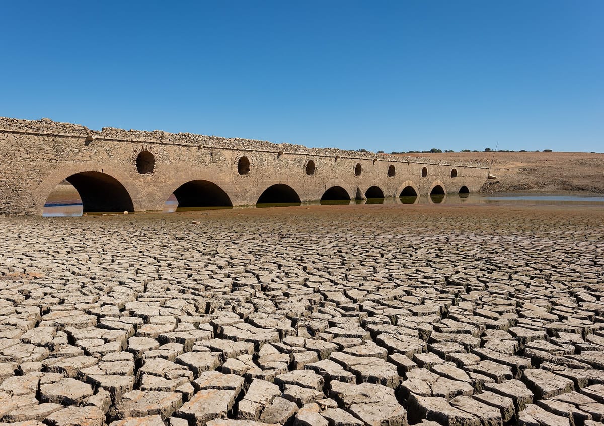
Eight months ago Portugal's soils were saturated and its dams close to full. Now the country closes the 2025/26 hydrological year with two droughts at once: a meteorological drought that has settled over the Alentejo and the Algarve, and a slower, reservoir-level drought in the north and centre, where six river basins are holding less water than their October average.
The swing was traced in a long analysis by Observador on Sunday. Data from the Instituto Português do Mar e da Atmosfera (IPMA, the national weather service) and the Agência Portuguesa do Ambiente (APA, the Portuguese Environment Agency) show how fast the surplus ran down, and where.
From the wettest start in 30 years
IPMA's February bulletin recorded 241.7 mm of rain on the mainland that month, 329 percent of normal and the wettest February in 47 years. From 1 October 2025 to the end of February, 923.8 mm had fallen, 179 percent of normal: the wettest start to a hydrological year in three decades. Every council had soil water between 60 and 100 percent, and there was no meteorological drought anywhere.
Then the rain stopped. By the end of July, after the driest July of the century, IPMA's drought index put 100 percent of the mainland in meteorological drought: 39.1 percent weak, 60.3 percent moderate and 0.6 percent severe.
A wet August, then a record-hot September
August brought 35.6 mm of rain, about 2.6 times the average, after a frontal system soaked Lisbon, the Tagus valley and the coast between Setúbal and Sines. IPMA's August bulletin, its most recent full drought assessment, found the North and the northern Centre back almost entirely in the normal class. The South went the other way: the interior of the lower Alentejo and the eastern Algarve got worse, and the area in severe drought grew.
At 31 August the mainland stood at:
- 29.5 percent normal
- 54.1 percent weak drought
- 9.2 percent moderate drought
- 7.2 percent severe drought
On paper the year was not short of rain: October to August brought 1,083.5 mm, 140 percent of normal. September undid some of August's relief. It was the hottest since records began in 1931, with only 12.7 mm of rain, about 30 percent of normal, according to IPMA's preliminary summary. In late August the government's technical drought group, using IPMA scenarios, said a dry September would widen the drought, with weak to moderate drought north of the Tagus and moderate to severe drought south of it. IPMA's end-of-September drought map comes with the full bulletin, normally published in the middle of the month, so the extent of the drought today is not yet officially known.
Reservoirs: the north is the weak spot
The dams are the part of the system that held. APA's weekly reservoir bulletin for 6 October puts total storage at 9,545 cubic hectometres, 72 percent of capacity, down 88 cubic hectometres from 30 September. Storage fell in 13 of 14 basins.
APA compares each basin with its own average for October. Every basin is above that line except six: the Lima, the Cávado, the Ave, the Douro, the Vouga and the Mondego. That is twice as many as on 21 September, when only three northern basins were under their norm. The Lima is the weakest at about 37 percent, with Alto Lindoso, its largest reservoir, at 35 percent. The Cávado is at about 58 percent, the Mondego 57 percent, the Vouga 63 percent and the Ave 50 percent. The Douro sits at 84 percent, a fraction under its average.
The south looks very different. The Mira basin is at 91 percent, the Guadiana at 78 percent with Alqueva at 80 percent, and the Algarve's Arade basin at 74 percent. At the end of August, Bravura, which supplies the western Algarve, held 81.6 percent, against 8.4 percent on the same date in 2023, according to Águas de Portugal figures in the government's August drought monitoring report.
That report, prepared for the Comissão Permanente de Prevenção, Monitorização e Acompanhamento dos Efeitos da Seca (the standing drought commission), found northern basins already in hydrological drought at the end of August, with the Mondego moving to moderate drought. Observador, citing APA, reports that by the end of September five basins were in hydrological drought, with the Ribeiras do Oeste the worst, classed as extreme, followed by the Lima (severe), the Mondego and the Vouga (moderate) and the Cávado (weak). APA has not yet published its September report.
What it means for households
- No restrictions on household water have been announced. Neither the government nor APA has declared drought restrictions on public supply this autumn.
- Farmers feel it first. In August, one of 64 irrigation reservoirs assessed (Pereiras) had no water left for agriculture and 11 more were under significant restrictions, the report says. APA also keeps its ban on licensing new boreholes in groundwater bodies classed as critical.
- Tanker deliveries are up in the north. Fire brigades carried out 1,701 water-supply runs in August, 26 percent more than in July, led by the districts of Bragança, Viseu and Braga. The report notes that not every run is drought-related.
What comes next
Early October brought some rain. IPMA described a slow-moving cut-off low between 2 and 6 October that produced heavy showers, hail and flash flooding, including a band of storms at least 100 km long over the Alentejo on 4 October. This week runs the other way: IPMA expects no rain and a likely October heatwave across much of the mainland.
The longer view is mixed. IPMA's seasonal forecast for October to December points to slightly more rain than normal in the North in October (5 to 10 mm above average), spreading to the Centre in November and December, with temperatures 0.5 to 1.5 °C above normal throughout. It gives no clear rain signal for the South, where the meteorological drought is deepest. Where and when the autumn rain falls will decide how the new hydrological year begins.