Storm Warnings Issued Across Portugal as Rough Seas and Strong Winds Forecast for Thursday Night
Multiple districts across mainland Portugal are set to come under weather warnings from Thursday evening, with IPMA — the Portuguese Institute of the Sea and the Atmosphere — issuing alerts for rough seas, powerful wind gusts, and snow in the...
Multiple districts across mainland Portugal are set to come under weather warnings from Thursday evening, with IPMA — the Portuguese Institute of the Sea and the Atmosphere — issuing alerts for rough seas, powerful wind gusts, and snow in the interior that will persist through Friday afternoon.
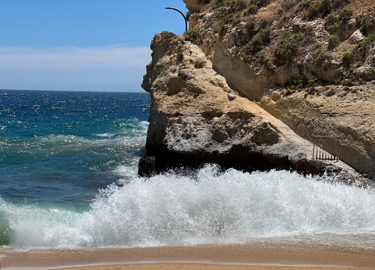
The Lisbon, Leiria and Coimbra districts face the most severe conditions, with a yellow warning taking effect at 9 pm on Thursday and escalating to orange from the early hours of Friday until 7 pm. IPMA forecasts northwest waves of between 5 and 6.5 metres in height along the coast, with the possibility of individual waves reaching 11 metres at peak. The Setúbal, Porto, Faro, Viana do Castelo, Beja, Aveiro and Braga districts are also under yellow warnings for rough seas during the same window.
The wind threat is widespread. Porto, Faro, Setúbal, Viana do Castelo, Lisbon, Leiria, Beja, Aveiro, Coimbra and Braga will all see a yellow wind warning between midnight Thursday and 7 pm Friday, with gusts forecast to reach 70 to 80 kilometres per hour along the coast and on exposed ridges. Residents are advised to secure outdoor furniture and avoid the seafront during peak conditions.
In the interior, the districts of Guarda and Castelo Branco face a yellow warning for snow above altitudes of 1,400 to 1,600 metres, effective from Thursday evening. Drivers using mountain passes in the Serra da Estrela or Serra da Gardunha should check road conditions before travelling and carry appropriate equipment.
The warnings follow a turbulent week on the Atlantic coast. Storm Regina brought significant disruption to Madeira earlier this week, resulting in the cancellation of more than 110 flights at Funchal's airport over Monday and Tuesday before operations returned to normal on Wednesday morning. The mainland system arriving Thursday night is a separate, though related, Atlantic disturbance and is not expected to cause the same level of flight disruption at Lisbon, Porto or Faro airports — though airlines may implement precautionary measures on certain routes.
IPMA has updated its warnings as of Wednesday morning and notes that further adjustments are possible. The agency recommends consulting its website for real-time updates, particularly for coastal districts and mountain roads. The warnings are expected to lift fully by Friday evening, with more settled conditions forecast for the weekend.
Anyone planning coastal activities — whether walking, watersports or fishing — on Thursday evening or Friday should treat the warnings as a firm reason to stay inland. The seafront promenades of Cascais, Estoril and Nazaré are likely to be particularly dramatic, but also genuinely hazardous, during peak swell.
Background: See the IC2 traffic restrictions imposed for the Fátima pilgrim flow.