Four Fifths of the Land Burnt Since 2020 Sits in Under a Third of the Mainland, and Seven Tenths of That Ground Is More Than 15 Minutes From a Fire Station
INE has laid 50,218 fires from 2020 to 2025 over the ICNF hazard chart. The high and very high classes cover 30.6 percent of the mainland and took 80.3 percent of the burnt area. Norte and Centro account for 90.7 percent of it, led by Covilha, Sabugal and Sernancelhe.
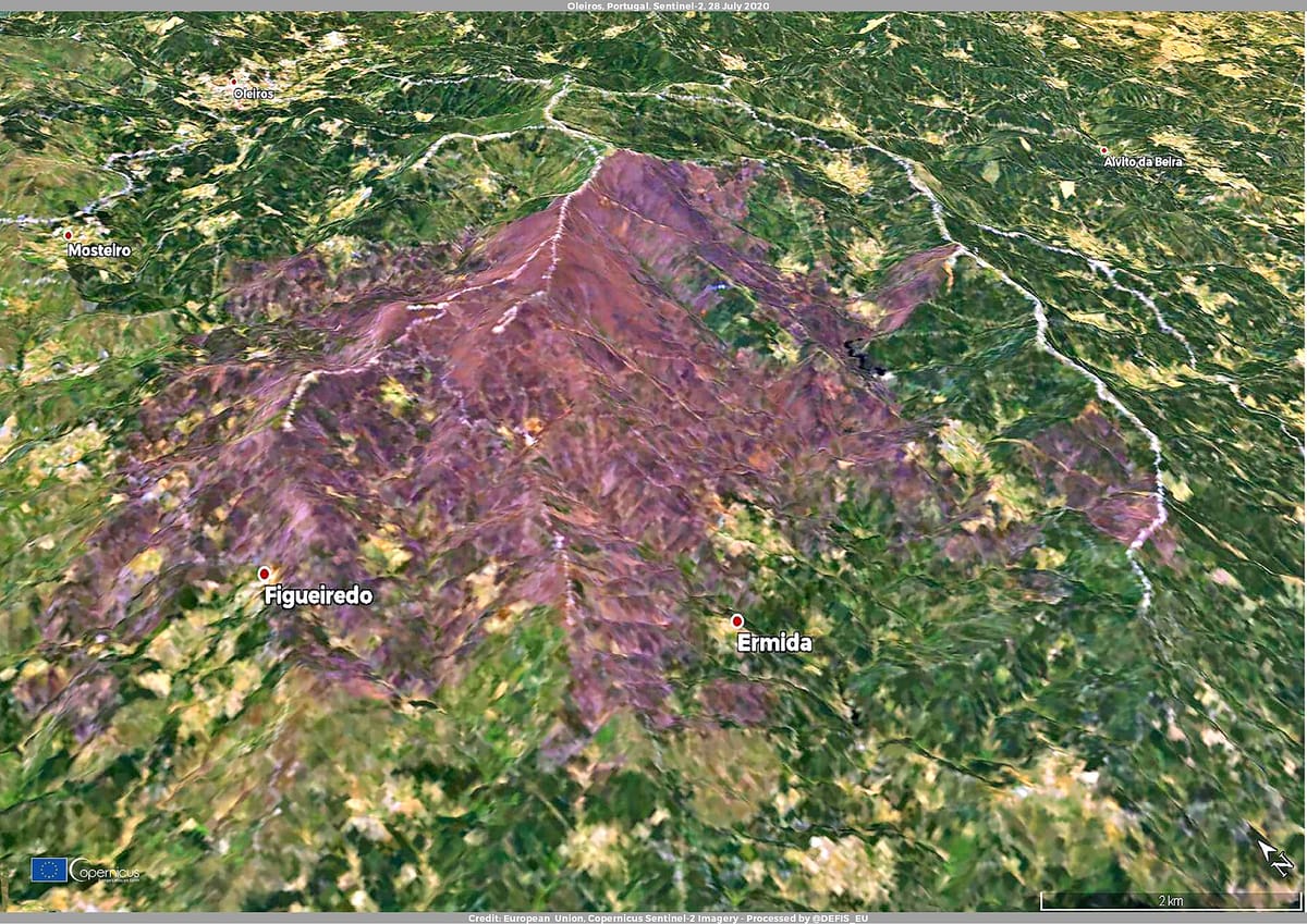
Portugal's statistics office has laid six years of fire history over the country's official fire-hazard map, and the result is a study in concentration. Between 2020 and 2025 the mainland recorded 50,218 fires with an identifiable point of origin. The land classified as high or very high hazard makes up 30.6 percent of the mainland. It absorbed 80.3 percent of everything that burned.
The release, published on Thursday by the Instituto Nacional de Estatística (INE), pairs the ICNF's structural rural-fire hazard chart for 2020 to 2030 with the fire and burnt-area records held in the SGIF, the national forest-fire information system. It is the second instalment of a series INE began in May.
Where fires start and where they spread are different questions
Ignitions are scattered. Only about 31 percent of the 50,218 starting points fell inside the two top hazard classes. A further 16 percent began in areas rated null, which is to say consolidated urban fabric, industrial estates and water, where the structural hazard model does not apply at all. The middle of the range, from very low to medium hazard, covers 61.5 percent of the mainland and produced 53 percent of the ignitions.
Burnt area behaves nothing like that. Of the 647,500 hectares that burned in the period, 519,900 were inside the high and very high classes, with the very high class alone taking 52.7 percent of the national total. Fires start more or less everywhere. They only run in a few kinds of country.
Two regions carry almost all of it. The Norte and Centro together account for 90.7 percent of the burnt area, split 42.1 and 48.6 percent. In both, the top two hazard classes cover more than half the regional surface. The ten worst-hit municipalities are all in those two regions, led by Covilhã with 28,800 hectares, Sabugal with 22,600 and Sernancelhe with 19,500.
What the dangerous ground is made of
In the very high class, forest and scrub together occupy 92.6 percent of the surface; in the high class, 84.5 percent. Read the other way round, 77.6 percent of all the scrub on the mainland and 47.0 percent of all the forest sit inside those two classes. Agriculture accounts for 8.4 percent of its own area there, pasture 6.5 percent.
Buildings are present too, and that is where the numbers stop being abstract. Residential built-up land inside the top hazard classes runs to 4,200 hectares, with another 1,000 in economic activity. Along the edges of those settlements INE counts 8,168 kilometres of direct interface, defined as a combustible patch of at least 0.1 hectares lying ten metres or less from the built perimeter, plus 1,373 kilometres of indirect interface.
The response time nobody talks about
The most uncomfortable figure in the release concerns coverage. Of the land classified high or very high hazard, 1,987,000 hectares, which is 69.6 percent of it, lie more than 15 minutes' travel time from a fire station. Bragança has 59,500 hectares in that condition and Montalegre 53,300, the only two municipalities above 50,000. Measured as a share of municipal territory, Góis and Pampilhosa da Serra pass 80 percent, and every municipality above 60 percent is in the Norte or Centro except Monchique in the Algarve.
The rankings overlap heavily. The councils with the longest interface, the councils furthest from a fire station and the councils with the most burnt land since 2020 are, to a large extent, the same councils. That includes Valpaços and the Vouzela area, where the July and August fires were formally recognised as a natural catastrophe this week.
What This Means for Foreign Residents
- Hazard class is a property question, not a weather question. The ICNF chart is public and parcel-level. If you are buying rural land in the interior, the class it sits in shapes both your insurance and your legal obligations to clear vegetation.
- Fifteen minutes is the number to check. Ask where the nearest corporação de bombeiros actually is, in driving time, not in kilometres. In much of the Norte and Centro the honest answer is more than a quarter of an hour.
- The interface figure explains the clearance rules. The 50-metre and 100-metre strips that landowners must keep clear exist precisely because of those 8,168 kilometres of direct contact between houses and fuel.
- The policy debate is about fuel, not ignition. Portugal has argued for years about what it plants and subsidises and about who commands the response. This dataset is an argument for the first.