Registering Rural Land on BUPi in Portugal in 2026: A Practical Guide to the 30 September Free Deadline, the RGG Your Sale Already Needs, and the 15-Year Route by Which Unclaimed Land Becomes the State's
Identification and registration of rural and mixed plots are free until 30 September, then €15 each. The RGG requirement for sales and for every subsidy application is already law. How to do it online from abroad, what to bring, and what happens to land nobody claims.
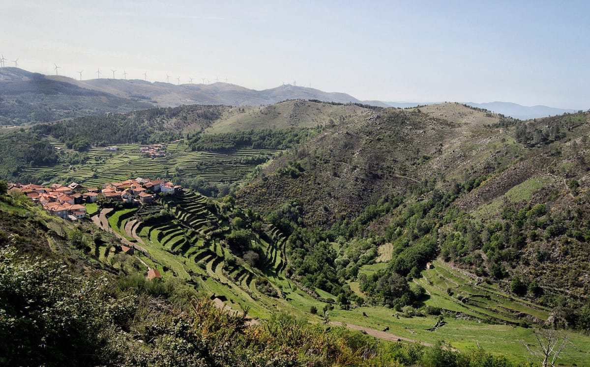
Portugal has never had a complete map of who owns its rural land. Across most of the north and centre, where holdings were split by inheritance for generations, boundaries were held in memory: a stone wall, a watercourse, a neighbour's grandfather's word. There is no line on any state map that says where your olive terrace ends.
The Balcão Único do Prédio, universally shortened to BUPi, is the state's answer. It lets you draw your plot on a map, attach that drawing to your tax record, and register it at the land registry. Doing it has been free. On 30 September 2026 the free window closes.
This guide is for anyone who owns, has inherited, or is about to buy rural land in Portugal, and for the large group of people who are not sure whether the family plot in the village is registered in anyone's name at all. It is written from the law itself: Lei n.º 78/2017 and Lei n.º 65/2019, both amended by Decreto-Lei n.º 87/2026 of 15 April, together with the Código do Registo Predial (Land Registry Code) and Decreto-Lei n.º 15/2019, which is the part nobody enjoys reading.
What BUPi covers, and what it does not
BUPi handles prédios rústicos (rural properties) and prédios mistos (mixed properties). In Portuguese property law a prédio rústico is land outside an urban settlement that is not classified as fit for construction. A prédio misto has a rural part and an urban part: the classic smallholding with a stone house at one corner and land around it.
Purely urban property, an apartment or a townhouse, is outside this system entirely. If that is what you own, this guide does not apply to you.
The system sits inside the Sistema de Informação Cadastral Simplificado (Simplified Cadastral Information System), which Portugal built as a parallel track after decades of failing to complete a conventional national rural cadastre. It is funded through the Recovery and Resilience Plan, under component C08, Florestas, in the investment line for rural property cadastre and land-cover monitoring. That funding origin is the reason the work has been free, and it is a good indication of why the free period keeps having an end date attached.
First question: does your municipality have a cadastre?
This determines which document you need, and it is the step people skip.
- Municipality without a cadastro predial. You must produce a Representação Gráfica Georreferenciada (RGG), a georeferenced graphic representation, through BUPi. This is most of the country.
- Municipality with a cadastro predial already in force. You do not need to do the BUPi identification. You present a Configuração Geométrica do Prédio (CGP), the property's geometric configuration, which already exists. BUPi's own guidance notes that you would produce a CGP in this case only if you want the benefit of the free registration.
The Direção-Geral do Território (Directorate-General for Territory) publishes a viewer that tells you which category your municipality falls into and whether a CGP already exists for your plot. Check that before you do anything else. The registration rules at the Conservatória are identical nationwide; only the georeferencing step differs.
In the autonomous regions, the annex to Decreto-Lei n.º 87/2026 lists twenty municipalities across the Azores and Madeira with no rural geometric cadastre or property cadastre in force, from Angra do Heroísmo and Horta to Ponta do Sol, Porto Moniz, São Vicente and Vila do Porto.
What changes on 30 September, and what already changed in April
These are two different things, and conflating them is the most common error in the coverage of this deadline.
Already in force: the RGG is compulsory for transactions
Decreto-Lei n.º 87/2026 took effect the day after its publication, in April. It rewrote Article 19 of Lei n.º 78/2017 so that quoting an RGG number is mandatory:
- in the documents that title acts or transactions transferring ownership of rural and mixed properties;
- in registrations of acquisition, anexação (annexation) and desanexação (detachment);
- in the special justification and annexation procedures under Lei n.º 65/2019; and
- in any administrative procedure before any public entity that changes the geometric configuration of a rural or mixed property.
There are two carve-outs. The requirement does not apply if an official check of BUPi shows the RGG has already been filed or the property is already on the cadastral map, and it does not apply to acquisitions arising from acts in enforcement or insolvency proceedings, or where a declaration of public utility already exists.
Article 19(3) adds the funding side, and it is broad: every application for, award of or grant of financial support, subsidies, incentives or co-financing, whatever the origin, expressly including European Union funds and national funds, concerning rural or mixed properties, must be filed with an RGG. A forestry restoration grant, a Common Agricultural Policy payment, a post-fire replanting line: all of them.
So the practical wall is already up. What the deadline changes is the price of climbing it.
From 1 October: it costs money
Under Article 14(1) of Lei n.º 65/2019 as amended, the acts and procedures covered by the law are free until 30 September 2026 for rural or mixed properties with an area equal to or under 50 hectares. That cap covers essentially every plot a private household owns.
From 1 October 2026, Article 14(7) sets a price for each RGG carried out by qualified technicians who work for, or provide services to, municipalities and intermunicipal entities and are registered in BUPi to assist citizens:
- €15 per RGG, up to the ninth;
- €10 per RGG, from the tenth onward.
For one plot that is a symbolic sum. For an inherited holding of five scattered parcels it is €75, and for a fragmented family estate it stacks quickly. Note what the provision actually prices: technician-assisted RGGs at a BUPi counter. It does not set a fee for the identification you draw yourself on the platform.
The registration at the Conservatória do Registo Predial is the other half. It is free until 30 September for properties never registered, or whose registration is out of date. After that the ordinary emolument rules return, softened by one provision the same decree inserted: a list of registry fees is reduced by 65 percent where the act concerns only rural properties worth under €10,000.
The free administrative conciliation procedure run by a qualified technician, used to settle boundary disagreements, also expires on 30 September 2026.
Step one: identify the land (the RGG)
Identification is always free and can be done four ways.
- Online, on the BUPi platform. Authenticate with your Cartão de Cidadão (card reader and plugin required) or with the Chave Móvel Digital and its PIN. You do not need to create an account; the authentication is the account. Draw the polygon over the digital map.
- With the BUPi app. Any phone or tablet with GPS and an internet connection. You can walk the boundary physically and mark it as you go, which is the only realistic method for land where the corners are a wall and a chestnut tree. You can also mark it on the map without going anywhere.
- With Google Earth Pro. Draw the polygon there and upload the file.
- At a BUPi counter (balcão). A qualified technician does the drawing with you. Every participating municipality has one. There are also registered cadastral technicians and certified solicitadores who work in specific councils.
If you upload a file, whether from the app, from Google Earth Pro or from an earlier GPS survey, the accepted formats are KML, GPX, TopoJSON and Shapefile zipped as .zip. Remember to export and download the file before you try to upload it.
If you cannot find your own land
This is far more common than newcomers expect, particularly with inherited plots that nobody has walked in twenty years. Three tools exist for it: the app's GPS mode, a deduction function on the platform that infers a likely location from surrounding data such as neighbouring properties, and the technicians at the counter who can run the same deduction with you.
What to bring
For the identification, online or in person:
- Cartão de Cidadão with PINs, or Chave Móvel Digital with the associated phone.
- The caderneta predial, the tax record, which carries the artigo matricial numbers of the plots you are georeferencing. At a counter you can instead give the matrix number and your NIF and let the technician pull the caderneta from the Portal das Finanças, but bring the document if you have it.
- Any GPS survey you already had done.
For the registration at the Conservatória you additionally need a document proving title. Any one of:
- a deed of purchase and sale, or of gift;
- a deed of habilitação de herdeiros (declaration of heirs);
- a judicial decision granting you ownership;
- a law or other legal instrument granting you that right.
Who is allowed to do it
The 2026 decree widened the definition of interessados, and the list is more generous than most people assume. You can promote an RGG if you are:
- the sujeito passivo on the tax matrix, meaning the person named on the caderneta predial;
- the person registered at the land registry as owner or usufructuary;
- anyone entitled to request registry acts at the Conservatória, which expressly includes buyer and seller in a sale, donor and donee in a gift, notaries, solicitadores and lawyers under a duty to promote registration, a surviving spouse or an heir in respect of assets in an undivided estate, and any co-owner;
- anyone holding powers of representation under a power of attorney.
The amended law adds a further category for rural properties missing from the tax register and not described at the registry: anyone who can prove their right by legal document, or who declares that, being the owner, they will start a justificação de direitos.
The awkward cases, resolved
- The matrix is in the name of the estate. Any heir can promote the RGG. Bring the caderneta plus one of: proof of the estate's NIF, the habilitação de herdeiros, or the will with the death annotated.
- Several co-owners. One co-owner promotes it, but every other co-owner listed on the caderneta must be identified in the process.
- The matrix is in one spouse's name and the other is doing the work. The promoting spouse does the RGG using the matrix data. Title is dealt with at the registration stage, not here.
- A company owns it. Give the NIPC, plus the permanent certificate access code if the entity is subject to commercial registration, or the articles and the appointment and inauguration of the governing bodies if it is not.
- You are acting for someone else. A power of attorney is required, but it needs no special form: a signature and the identification document of the principal suffice. BUPi publishes a simplified model, which confers powers for the RGG procedure only. If the principal cannot sign, someone may sign at their request, and that signature must be certified before a registry office, a notary, or a lawyer or solicitador.
- You are on the matrix as nobody. Where you are neither the matrix taxpayer nor the registered owner, you generally complete a declaração de legitimidade, a sworn statement of standing. BUPi publishes the model. It does not cover every scenario, because Article 36 of the Land Registry Code allows registration to anyone with an interest, but it covers most.
If you have no document proving the land is yours
This is the position of a great many rural plots in Portugal, and it is not fatal. The route is a justificação de direitos, run either as a procedure at the Conservatória or as a notarial deed of justification, and typically grounded in usucapião, acquisitive prescription. You demonstrate that you live on or work the land under conditions that allow it to be registered in your name. Start with the Conservatória nearest the property.
If the plot is not even on the tax register
For a rural property omisso na matriz, missing from the tax register, in a council without a cadastral matrix where BUPi is operating, the sequence is fixed:
- At the BUPi counter, complete the declaration that starts the registration of an omitted property and a provisional RGG.
- Go to the tax office with the application to register the omitted property and a declaration of acceptance from at least one neighbouring owner.
- Once the matrix article is issued, return to the BUPi counter to finalise the RGG and promote registration at the Conservatória.
The amended law provides that once the declaration is filed with its supporting documents, the property is entered on the matrix with a provisional article number, even before the taxable value is fixed.
When the area is wrong
Old cadernetas are frequently wrong about area, sometimes by a lot. What you do depends on which document is wrong.
- The area on the caderneta is wrong. Do the RGG first. The correct area is then communicated to the tax office automatically between services. You do not go to Finanças yourself.
- Some other caderneta detail is wrong, for instance a boundary description. Go to the tax office first, then do the RGG.
- The registered area is wrong. Complete the RGG, then go to the Conservatória and apply to correct the area, declaring that you want the RGG area to be the one that counts. Article 16 of Lei n.º 78/2017 applies alongside the Land Registry Code, and the RGG can serve as the basis for that declaration or replace the property plan the Code would otherwise require.
Watch this deadline. The 2026 decree amended Article 8.º-C of the Land Registry Code so that registration of a change of area, of matrix article, or of parish or municipality for properties with a property identification number must be applied for within two months of the RGG being carried out. An area shown on an RGG without a geometry reservation becomes definitive on registration and is annotated to the property description.
Overlaps, reservations and the neighbours
The simplified cadastre is declarative. You are asserting where you believe your boundary runs, and so is everyone else. Conflicts surface, many of which existed quietly for decades.
Two rules save time:
- Never draw over the public domain. If your polygon overlaps a road, a watercourse or other public land, the qualified technician will refuse the RGG outright.
- Overlapping a neighbour who has not georeferenced is survivable. You can still register; the RGG is validated with reservation (com reserva).
An RGG validated by every neighbouring owner has a different status. Under the amended Article 5 of Lei n.º 78/2017 it takes on the nature of cadastro predial for all legal purposes once communicated to the Direção-Geral do Território for integration into the cadastral map, and the DGT then notifies owners of that integration.
Portugal has begun clearing reservations in bulk through public consultations. The first, under Article 7.º-C of Lei n.º 65/2019, opened on 20 May 2026 for the Aljão landscape management area in Gouveia, covering parts of Cativelos, Ribamondego, Arcozelo da Serra and the united parishes of Rio Torto and Lagarinhos, running 60 working days. Owners can view the RGGs on the BUPi GeoPortal's public consultation map and lodge an objection online or at the counter. Every document supporting an objection must be attached at once, because nothing can be added after submission.
The consequence for anyone who ignores such a consultation is written into the rules: neighbouring properties not identified during the procedure become subject to the no-known-owner process.
The part that should concentrate the mind
Decreto-Lei n.º 15/2019 creates a procedure for identifying and recognising rural or mixed property with no known owner, meaning property not registered in anyone's name. It runs in three phases.
- Identification and publicity. The Instituto dos Registos e do Notariado identifies the property using the cadastral information in BUPi and data from public bodies, notably councils and the tax authority, and makes public that it has no known owner. If nobody contests within 180 days, the property is recognised as ownerless.
- Provisional registration for the State. The property is registered provisionally in the State's name. Anyone claiming ownership may still appeal. Management passes to Florestgal, and the tax authority is notified.
- Definitive registration. After 15 years without anyone proving ownership, the provisional registration becomes definitive. Within that window, anyone who proves ownership gets the property back. At the end of it the managing entity notifies the IRN, interested parties have 30 days to comment, the Direção-Geral do Tesouro e Finanças issues a binding opinion, and the land enters the State's private domain.
During those 15 years the property cannot be definitively transferred or encumbered, so the State cannot sell it out from under a returning heir. That is the safeguard. It is still a process that starts with a notice you did not read about land you did not know you owned.
New in 2026, and worth knowing
- The state will now write to you. A new Article 8.º-B of Lei n.º 78/2017 obliges the Technical Coordination Centre to notify each taxpayer on the rural or mixed property matrix, quarterly, in writing by email or post, of the estimated geographic location of their plot, so they can carry out the RGG. If you own rural land and have a current address on file, expect contact.
- A special annexation procedure. A new Article 7.º-F of Lei n.º 65/2019 lets you apply at BUPi to merge adjoining rural plots. The registry service starts the procedure within 90 days where a BUPi check shows an RGG exists, and if something is missing you have 10 days to supply it, which you can do through the platform. If you instead file an ordinary annexation request under the Land Registry Code while this one is pending, the special procedure is automatically extinguished.
- The State has its own deadline. RGGs for private-domain property of the State, the autonomous regions, local authorities and public institutes must be done by 31 December 2027. Public bodies are not exempt from the exercise.
- Wider promotion rights. Forest management entities, managers of forest intervention zones, promoters of integrated landscape management areas, farmer and forest producer organisations and their associations, and expropriating entities in public utility expropriations may all promote RGGs. If your land sits inside a ZIF or an AIGP, ask whether the managing body is doing this collectively.
What This Means for You
- If you inherited land and have never touched it: you are the person this deadline is aimed at. Any heir can promote the RGG on an undivided estate; you do not need the other heirs to agree first, only to be identified. Bring the caderneta and the estate's NIF or the habilitação de herdeiros. Doing nothing carries a real, if slow, risk of the no-known-owner procedure.
- If you are buying rural land: the RGG number is already compulsory for the transfer document. Before you sign anything, check on BUPi that the plot has one. If it does not, the seller has to produce it, and that is a negotiating point and a timing risk, not a formality.
- If you are selling: get the RGG done before 30 September while it is free, and while counter appointments are still obtainable. Expect the last weeks of September to be congested.
- If you live abroad and own land in the village: you can do the whole identification online with a Chave Móvel Digital, without travelling. Where you cannot locate the plot, appoint a relative by simplified power of attorney: signature plus identification document, no notary needed, using BUPi's model. The Portal das Comunidades Portuguesas carries BUPi information for non-resident citizens.
- If you farm or manage woodland: Article 19(3) applies to you directly. No RGG, no subsidy application, whatever the fund. Check whether your producer organisation, ZIF or landscape management entity is running a collective RGG operation, which is usually faster than doing it alone.
- If your land is in a municipality that already has a cadastre: you are not obliged to use BUPi. Check the Direção-Geral do Território viewer for a Configuração Geométrica do Prédio, and use the free window only if you want the registration at no cost.
- If a boundary is disputed: use the free administrative conciliation procedure with a qualified technician before 30 September. After that date the free route closes and your remaining options are more expensive.
What to do this month
- List every rural or mixed plot you own or have an interest in, and pull the caderneta predial for each from the Portal das Finanças.
- Check on the Direção-Geral do Território viewer whether each council has a cadastre.
- Check on BUPi whether an RGG already exists for the plot. It may: a co-heir or a management entity may have done it.
- For anything missing, either draw it yourself on the platform or book a balcão appointment now, not in the last week of September.
- Take the finished RGG to the Conservatória do Registo Predial and register, with your title document, or start a justificação if you have none.
- If you corrected an area, apply for the registry change within two months of the RGG.
The state has spent nine years asking Portuguese landowners to do this voluntarily, and paying for it. That phase ends on 30 September. What follows is not a penalty regime; it is a price list and a set of doors that no longer open without a number. The €15 is not the reason to act. The reason to act is that the plot you cannot point to on a map is, in law, difficult to sell, difficult to fund, difficult to leave to anyone, and eventually difficult to prove is yours.