Scientists Off Madeira Fit a Satellite Tag to a Blainville's Beaked Whale, a Deep-Diving Species Rarely Seen There
The tag should track the animal for six months. It is the high point so far of the Madeira Ocean 2026 expedition, which runs until 28 October around the islands' marine protected areas.
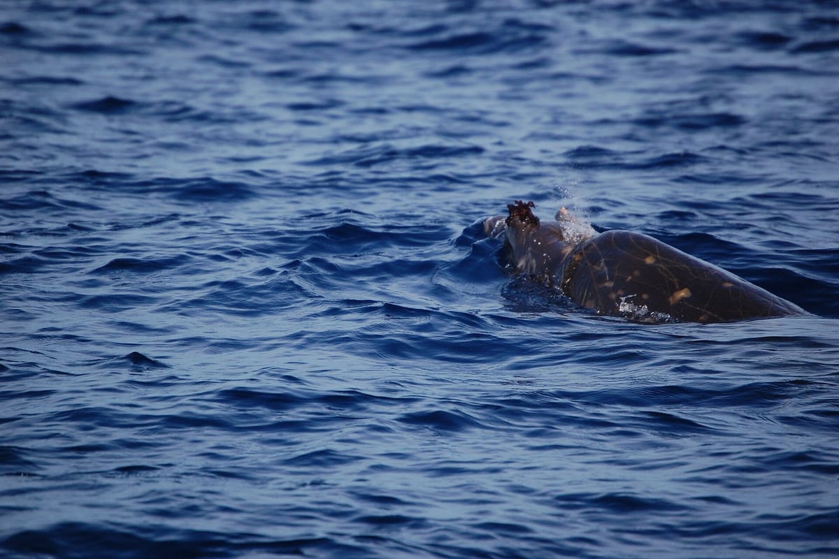
Scientists on a month-long expedition around Madeira have fitted a satellite tag to a Blainville's beaked whale, a deep-diving species that is very hard to spot in the archipelago, the expedition's scientific coordinator, Beatriz Vinha, told Lusa on Tuesday.
The tag will stay on the animal for about six months and will let researchers follow where it goes. Vinha said the team from MARE-Madeira, the regional marine research centre, told her it was the first time anyone had managed to tag this whale in that part of the Atlantic, and possibly in the whole ocean, though that still has to be confirmed. She called it the main milestone of the expedition's first stage.
A whale that lives in deep water
Blainville's beaked whales have been seen off Madeira before, but they spend most of their time in deep water, which makes it hard to get close enough to tag them. "This tagging lets us understand more about its ecology and distribution and, in the end, learn more about how important Madeira is as a habitat for these animals," Vinha said. The team also used short-term tags that stay on for a few hours and are then removed.
The Madeira Ocean 2026 expedition
The first stage ran from Friday to Monday around the Desertas Islands and off Funchal. Researchers used baited underwater video systems (BRUVs), a remotely operated vehicle that found fields of black coral, environmental DNA sampling, a manta trawl (a fine net towed at the surface) and surveys of the intertidal zone. Divers could not work at the Desertas because the Mediterranean monk seals there are breeding, so they worked at Cabo Girão instead.
The second stage began on Tuesday along Madeira's south coast and runs until Friday, with work in the Garajau and Cabo Girão marine protected areas, which Vinha described as "very special" reference sites for the region. The expedition ends on 28 October and will also cover the north coast and Porto Santo.
Its main ship is the Santa Maria Manuela, a former cod-fishing schooner, supported by 13 other vessels. The ship was in the port of Funchal on Tuesday and stays there on Wednesday, open to the public and hosting activities for more than 700 pupils from schools on the island, before heading back out to sea.
Who is behind it
The expedition is promoted by the Government of Madeira, the regional Institute of Forests and Nature Conservation (IFCN), the regional research agency ARDITI, the Fundação Oceano Azul, the Oceanário de Lisboa and National Geographic's Pristine Seas programme. It brings together 34 partners and about 200 people, some 120 of them scientists.
It has three aims: to assess the current state of Madeira's marine protected areas, to explore new areas of ecological interest, and to set up a monitoring programme for long-term studies of the protected areas. Work is being done both inside and outside protected zones so that the results can be compared, from coastal and mesophotic waters between 30 and 200 metres deep to deep-sea ecosystems between 200 and 1,000 metres. The findings are meant to inform the region's decisions on marine protection.