Hiking in Portugal in 2026 — A Practical Guide to the Rota Vicentina Fishermen's Trail, the Caminho Português de Santiago, Serra da Estrela's Long Trail, Madeira's Levadas, the Açores Trilhos, and the FCMP Markings System (PR/GR/E)
Portugal's hiking stack runs from the Rota Vicentina Fishermen's Trail (226 km) and the Caminho Português de Santiago to Serra da Estrela's GR50, Madeira's levadas, and the Açores trilhos — all marked under the FCMP system. A 2026 guide for foreign residents to routes, season, gear and federation.
Portugal is, by any honest measure, one of the great hiking countries of Europe. The Atlantic-coast cliff-top architecture of the southwest, the Levadas of Madeira, the GR50 across Serra da Estrela's plateau at 1,500 metres, the Açores volcanic-crater trilhos, and the Caminho Português de Santiago route to Galicia together produce a hiking stack that any foreign resident with an interest in long-distance walking can spend a decade working through without exhausting.
This is the practical 2026 guide to that stack: the marked-routes system, the major trails, the federation architecture (FCMP), the seasonal calendar, the gear ladder, the accommodation-and-services layer, and the rules around dogs, drones, fires, wild camping and group-size limits.
The FCMP markings system: PR / GR / E
The first thing to know is the markings code. Portugal's marked-trail network is governed by the Federação de Campismo e Montanhismo de Portugal (FCMP) under European hiking-federation rules harmonised across the European long-distance-trails network (Eurorando / European Ramblers' Association). All Portuguese marked trails carry one of three prefixes painted on rocks, posts and tree trunks at regular intervals:
- PR (Pequena Rota): short trails, typically loops, under 30 km, completable in a day. Markings are yellow-and-red parallel bars (correct direction), an X (wrong direction), and a right-or-left turn arrow.
- GR (Grande Rota): long-distance linear trails, over 30 km, multi-day. Markings are white-and-red parallel bars on the same architecture.
- E (European Long-Distance Path): Pan-European trails crossing Portugal — most notably E9 (Atlantic Coast, Cabo de São Vicente to Estonia) and E7 (Pyrénées to the Carpathians, with a Portuguese branch). Same white-and-red markings as GR.
The yellow-and-red PR markings can be intuitively decoded on the ground without a map: two parallel bars means continue, an X means "wrong way," an arrow turning into the markings means follow the turn. The white-and-red GR/E markings work the same way. The system is unified and consistent — once you know it for one trail, you know it for every other.
The Rota Vicentina — Portugal's flagship long-distance trail
The Rota Vicentina is the Portuguese long-distance trail that has the strongest international reputation, and for good reason. It is a network of marked trails through the southwest Alentejo and the Costa Vicentina natural park, with two principal routes:
- Caminho Histórico: 263 km, inland route, Santiago do Cacém to Cabo de São Vicente, 12 stages, can be hiked year-round.
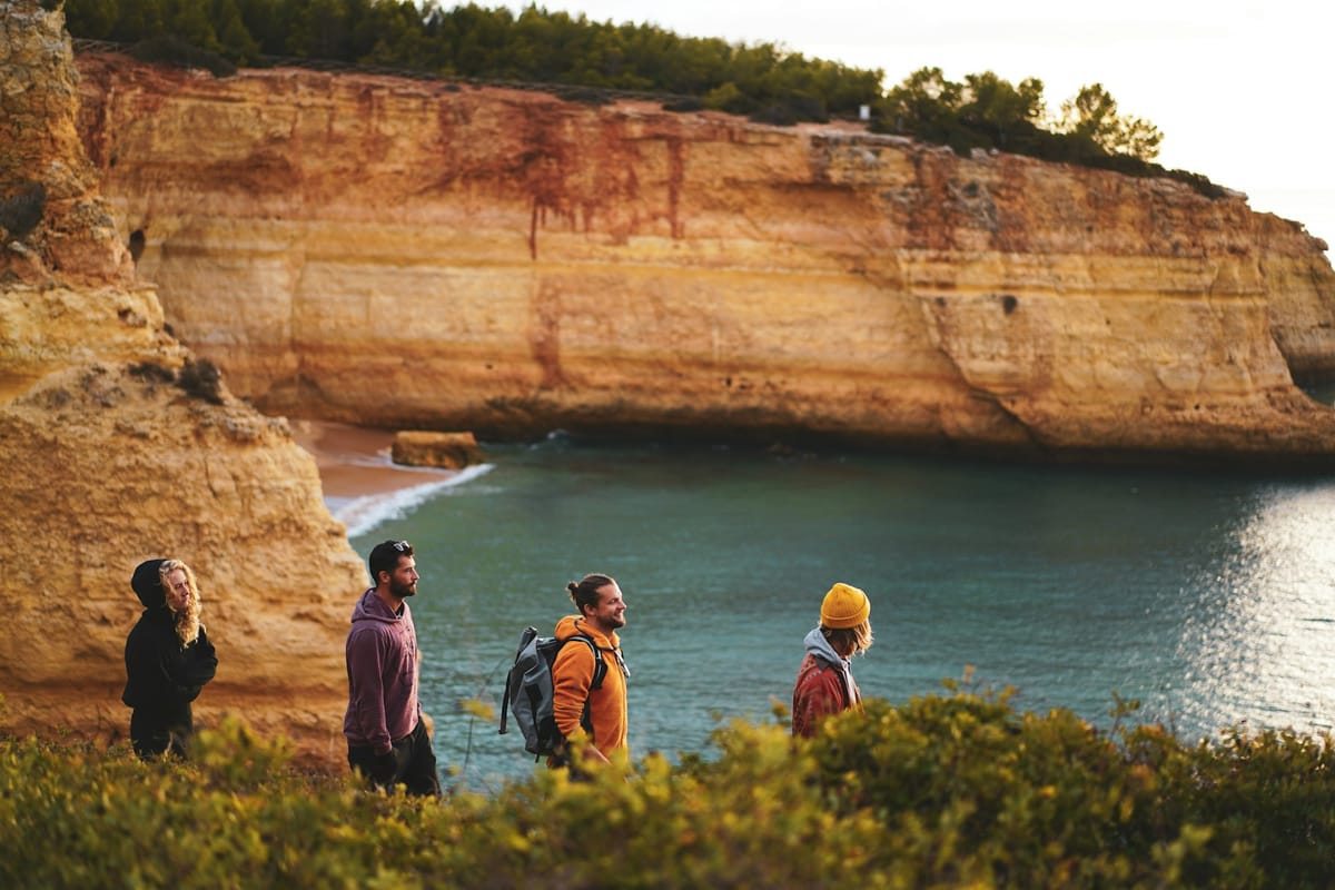
- Trilho dos Pescadores (Fishermen's Trail): 226.5 km, coastal cliff-top route, São Torpes (Sines) to Lagos, 13 one-day stages, hikeable September-June (too hot July-August).
The Fishermen's Trail is the famous one — the cliff-top sections produce some of the most photographed hiking landscapes in Europe. Distances per stage are manageable (typically 13-22 km) but over 60% of the path is sandy, which adds to the effort. The trail is not recommended for hikers with vertigo or a fear of heights — multiple stages run within metres of unfenced cliff edges. Maximum group size on the Fishermen's Trail is 15 people, and wild camping is not allowed.
The wider Rota Vicentina network adds the Circular Routes (loop trails of 4-22 km from local villages, typically PR-marked), giving hikers the option to mix multi-day sections with day loops. The federation behind the Rota Vicentina (Associação Rota Vicentina) handles trail maintenance, signage, and the publication of the canonical trail map and route descriptions.
The Caminho Português de Santiago
Portugal is part of the wider Camino de Santiago architecture, with several distinct routes converging on Santiago de Compostela across the Galician border. The principal Portuguese routes are:
- Caminho Central (Central Way): Lisboa to Santiago via Tomar, Coimbra, Porto, Barcelos and Valença. The full route is 620 km from Lisboa, or 240 km from Porto (the more popular start point). The Lisboa-to-Porto leg adds 380 km.
- Caminho da Costa (Coastal Way): Porto to Santiago via Vila do Conde, Esposende, Viana do Castelo and Caminha (where the route crosses the Minho into Galicia). 280 km, more scenic than the central route, runs parallel to the Atlantic.
- Caminho Interior (Interior Way): Viseu to Verín (Spain) via Lamego and Chaves. 250 km, less crowded, more demanding terrain.
The Caminho Português is yellow-arrow marked on the Spanish-Galician model rather than FCMP markings, and culminates in the Compostela credential at Santiago. Most foreign residents who walk the route do the Porto-Santiago leg over 12-14 days; the Lisboa-Porto extension adds another two weeks. Albergue (pilgrim hostel) accommodation is available throughout, with peregrino prices typically €8-€15 per night.
Serra da Estrela — the high-altitude option
The Serra da Estrela natural park hosts Portugal's highest mainland elevation (Torre, 1,993 m) and its principal high-altitude hiking-and-mountaineering grounds. The marquee long-distance route is the GR50, a 142-km circular route across the plateau that takes 6-9 days to complete. The trail runs through Manteigas, Covão d'Ametade, Lagoa Comprida, Penhas Douradas and Sabugueiro, traversing terrain that ranges from valley pastureland to alpine plateau above 1,500 m. Snow cover is reliable from December to March; the trail is hikeable May-October.
For day hikes, the Trilho dos Glaciares from Manteigas (12 km, PR-marked) is the most widely walked, taking in the U-shaped glacial valley of the Vale do Zêzere. Mountain refuges (refúgios) operated by the Instituto da Conservação da Natureza e das Florestas (ICNF) and the FCMP provide overnight shelter on the GR50 — booking in advance is essential during the May-October window.
Madeira's Levadas
Madeira's hiking architecture is structurally different. The island's irrigation channels — levadas — were built between the 16th and 20th centuries to carry water from the wet north to the dry south, and the maintenance paths alongside them have become the principal hiking network. There are over 1,400 km of levada paths on the island, of which roughly 200 km are marked as PR routes by the Madeira regional tourism authority.
The most hiked routes are PR1 (Vereda do Pico do Areeiro to Pico Ruivo, the high-altitude ridge crossing the island's two highest peaks at 1,818 m and 1,862 m), PR6 (Levada das 25 Fontes), PR9 (Levada do Caldeirão Verde) and the Vereda da Ponta de São Lourenço (PR8, the dramatic eastern peninsula). Levada hiking is generally low-gradient (the channels follow contours) but tunnel sections require headlamps, and the high-altitude PR1 ridge route requires sure footing and weather awareness.
Açores — the volcanic option
The Açores' nine islands have a network of around 80 PR-marked trilhos managed by the regional tourism authority Direção Regional do Turismo. The marquee routes include the Pico do Pico ascent (the highest peak in Portugal at 2,351 m, on Pico Island, requires a guide and a regional permit), the Lagoa do Fogo loop on São Miguel, the Sete Cidades caldera traverse on São Miguel, the Caldeira do Faial summit, and the Furnas thermal-valley loop. The Açores' weather window is year-round but unpredictable — Atlantic-front systems can deliver rain at any season, and high-altitude trails can be closed at short notice for visibility.
Other major hiking grounds
Beyond the marquee networks, the Portuguese hiking stack includes:
- Peneda-Gerês National Park (the only national park, in the far north): the GR50-Gerês traverse, multiple PR loops from Soajo, Lindoso and Campo do Gerês.
- Serras de Aire e Candeeiros (central limestone): Polje and karst-cave PR trails.
- Arrábida natural park (Setúbal peninsula): coastal-ridge PR trails with sea views.
- Sintra-Cascais natural park: the Cabo da Roca-to-Praia da Adraga coastal walk, multiple Sintra-mountain PR loops.
- Alvão natural park (Trás-os-Montes): Fisgas de Ermelo waterfalls and the Lamas de Olo plateau.
- Douro Internacional natural park: cliff-top trails on the Spanish-Portuguese border with vulture-population observation points.
The seasonal calendar
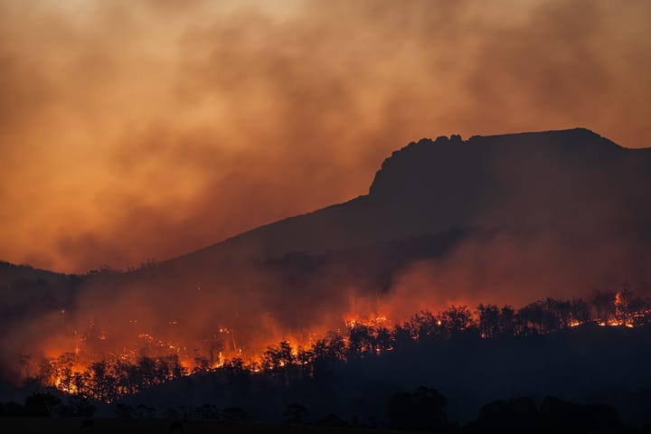
Portuguese hiking has clear weather windows. The southwest coast (Rota Vicentina, Algarve, Alentejo coast) is best in autumn (mid-September to mid-November) and spring (mid-March to early June); July-August is too hot. The Caminho Português and northern routes are best March-November; December-February is hikeable but rainy. Serra da Estrela GR50 is May-October. Madeira and the Açores are year-round with weather caveats. Mainland heat-wave conditions can deliver 40°C+ in July-August inland — the FCMP and ICNF issue red-warning trail closures during heat-wave-and-fire-risk peaks.
Gear and equipment
Portugal's marked-trail network is well-served, but the gear ladder for multi-day hiking is real:
- Boots: mid-cut waterproof hiking boots €120-€250. Trail runners are workable for the Caminho Português but inadequate for Serra da Estrela's GR50 or Madeira's PR1.
- Backpack: 30-40 L for multi-day with hostel/albergue accommodation; 50-65 L for self-supported camping (where permitted).
- Rain shell: mandatory year-round on northern routes and Madeira/Açores.
- Headlamp: essential for Madeira levada tunnels and Serra da Estrela early starts.
- First-aid kit, blister treatment, sun cream, water (2-3 L per day in summer).
Decathlon's Quechua line is the dominant entry-level brand in Portugal; Continente Bom Dia and Sport Zone stock midrange options. Specialist outdoor retailers (Trilhos & Caminhos, Globos, Decathlon Avenida da República in Lisboa) handle the higher-end Salomon / Lowa / Scarpa / Osprey / Deuter inventory.
The federation architecture: FCMP, ICNF, regional authorities
The institutional architecture sits across three layers. The FCMP (Federação de Campismo e Montanhismo de Portugal) is the federation that homologates marked trails on the mainland and federates the regional camping-and-mountaineering associations. The ICNF (Instituto da Conservação da Natureza e das Florestas) manages the natural parks and protected-area trail network. Regional tourism authorities (Madeira Regional, Açores Regional, Alentejo Regional, Algarve Regional) handle local trail signage and publication. Foreign residents who plan to hike regularly should consider FCMP membership (annual fee, includes hiking insurance and refúgio booking access) and ICNF protected-area registration where required.
Rules: dogs, drones, fires, wild camping
The rules are uniform across the system: dogs must be leashed at all times in protected areas. Drones are prohibited in natural parks without prior ICNF authorisation. Open fires are forbidden during the entire critical fire period (typically 1 July to 30 September, often extended). Wild camping is illegal in all natural parks and on the Rota Vicentina; designated campsites and rural-tourism alojamentos are the alternative. Group sizes on the Fishermen's Trail are capped at 15. Pico do Pico requires a regional permit and a registered guide.
What this means for foreign residents
Hiking is one of the highest-engagement Portuguese practical-lifestyle decisions for foreign residents — alongside surfing and cycling, which the Brief has already covered in the 2026 guide series. Where surfing is concentrated on the Atlantic-facing coastline and cycling spans the urban-and-long-distance EuroVelo network, hiking maps onto the natural-park system and the long-distance-trail spine that runs from Cabo de São Vicente to the Galician border.
The reasonable starting point for new arrivals is a single PR loop (Sintra-Cascais, Arrábida, or one of the Madeira day routes if you are island-resident). The progression from there is a 4-6 day Fishermen's Trail section (autumn or spring), then the Porto-Santiago leg of the Caminho Português, then the GR50 of Serra da Estrela. Two seasons in, you are inside the wider European long-distance trail network and the Portuguese hiking stack opens up to its full breadth.