Going to the Beach in Portugal in 2026 — A Practical Guide to the 396 Bandeira Azul Beaches, the ISN Lifeguard Calendar, the Praia Acessível Programme, the Águas Balneares APA Reports and the Algarve, Costa de Prata and Costa Verde Maps
Portugal's 1,793-kilometre Atlantic coast carries 396 Bandeira Azul beaches in 2026. This practical guide walks the institutional architecture — the Bandeira Azul ecolabel, the ISN lifeguard calendar, the bandeira colour code, the Praia Acessível programme and the Águas Balneares APA reports.
Portugal's coast — the 1,793-kilometre Atlantic continental seaboard plus the volcanic island arcs of the Açores and Madeira — is one of the highest-yield daily-life amenities in the country, and going to the beach is the single most universally-shared summer ritual that ties together the resident population. For the foreign resident, the practical infrastructure that makes the beach safe, accessible and legible — the Bandeira Azul ecolabel network, the ISN-supervised lifeguard calendar, the bandeira-vermelha/amarela/verde colour code, the Praia Acessível programme for reduced-mobility access, the APA Águas Balneares water-quality reports, and the seasonal lifeguard rotation — is the operational primer that turns the 1,793-kilometre coastline from "a place where people swim" into a navigable, season-by-season system. This guide walks the architecture from the institutional framework down to the regional maps for the 2026 summer season.
The headline 2026 number: 396 Bandeira Azul beaches
The Associação Bandeira Azul de Ambiente e Educação — ABAAE, the Portuguese branch of the international Foundation for Environmental Education that runs the Blue Flag programme worldwide — confirmed the 2026 award list this spring. Portugal carries 396 Bandeira Azul beaches for the 2026 summer season, plus 21 marinas, 21 ecotourism vessels and a programme of 1,093 environmental-education activities tied to the Blue Flag-awarded sites. The Bandeira Azul is awarded annually on the basis of bathing-water quality, environmental management, environmental education, safety and services, and the criteria are reviewed by a national jury that draws on APA water-quality data, ICNF coastal-habitat data, Capitanias dos Portos navigation-safety data and Direção-Geral da Saúde public-health data.
The award is what the visible blue flag flying from the lifeguard tower at the entrance to the beach signals. It is also a useful first-pass screen for foreign residents new to a stretch of coast: a Bandeira Azul beach is, by construction, a beach with reliable bathing-water quality, with operating lifeguards in season, with sanitary infrastructure on site, with environmental-management standards in force, and — increasingly important — with the bathing-area cordon and access discipline that keep the swimming zone safe.
The bandeira colour code — the operational primitive of Portuguese beach safety
The single most important operational primitive on a Portuguese beach is the colour-coded flag flown from the lifeguard tower (Posto de Praia ISN) and reproduced on the Posto entrance signage. The Instituto de Socorros a Náufragos — the rescue-and-lifeguard service operated under the Marinha Portuguesa — runs the system. There are four flags:
- Bandeira Verde (Green): swimming permitted, lifeguard on duty, sea conditions assessed as safe.
- Bandeira Amarela (Yellow): swimming with caution, lifeguard on duty, do not swim out of depth, do not use inflatables.
- Bandeira Vermelha (Red): swimming prohibited, sea conditions assessed as dangerous, lifeguard on duty.
- Bandeira Xadrez (Chequered Black-and-White): beach unsupervised — no lifeguard on duty at this moment, swim at your own risk.
The flag is the legal status of the swimming area at that moment — flying a red flag is not a warning, it is a prohibition. ISN-lifeguarded beaches with a red flag flying are off-limits to swimmers; the GNR and the Polícia Marítima can and do issue infringement notices for swimming during a red-flag interval. The chequered flag — sometimes shown as the "no lifeguard" flag — means the supervisory assessment is not active; you are on your own risk-and-rescue calculation. The flag is renewed at least once per day during the supervised season and as often as conditions require.
The ISN lifeguard calendar — when supervision is and isn't on
The Instituto de Socorros a Náufragos defines the official bathing season — the época balnear — by ministerial dispatch each year, with the headline window running broadly from 1 June to 30 September on the continental coast, with extensions and contractions by region and by individual concession. Most Algarve beaches and the Lisbon coast extend the supervised season into May and into early October on the warmer flank. The Açores and Madeira run their own local calendars, with the warmer sub-tropical climate keeping some pools and natural bathing complexes (especially in São Miguel and the Madeira archipelago) supervised year-round.
Outside the official época balnear, the ISN-trained lifeguard is not on duty, the chequered flag (or no flag) flies, and the swimmer is on their own risk calculation. That is the single most consequential calendar point for the foreign resident new to the coastline: the Atlantic does not soften because the calendar reads October, and rip-current incidents on the Costa de Prata and the Costa Verde are most concentrated in the unsupervised shoulders.
The Águas Balneares system — what the APA water-quality data tells you
The Agência Portuguesa do Ambiente publishes a public bathing-water-quality system — the Águas Balneares — that classifies bathing areas annually as Excelente, Boa, Aceitável or Má on the basis of microbiological sampling under EU Bathing Water Directive 2006/7/EC. The data is published at apambiente.pt under "Águas Balneares" and is updated weekly during the bathing season; an interactive map at apambiente.pt shows the current classification for each of the country's roughly 600 designated bathing areas, both coastal and interior (river beaches, lake beaches and reservoir beaches).
The vast majority of Portuguese coastal bathing areas — well over 90% — sit in the Excelente band. Where the picture deteriorates is occasionally on river beaches, where summer-low-flow conditions concentrate pollutants, and on a small number of urban-edge coastal sites in the Greater Lisbon and Greater Porto metro areas where storm-water overflow events from the combined sewer system can briefly compromise classification after heavy rain. The APA system is the authoritative reference; SNS24 also issues sun-safety and water-quality public-health advisories that pick up the APA data in its weekly summer bulletins.
The Praia Acessível programme — accessibility for reduced-mobility users
The Praia Acessível — Praia para Todos programme is a joint initiative of Turismo de Portugal, the Instituto Nacional para a Reabilitação and the Agência Portuguesa do Ambiente that classifies beaches against an accessibility checklist covering reserved parking, ramped or boardwalked access from the parking area to the supervised swimming zone, accessible sanitary facilities, amphibious chairs (cadeira anfíbia) on lend to bathers with reduced mobility, and trained beach-supervisor staff who can assist with the chair launch and recovery. The annual list — typically over 200 awarded sites — is published on the Turismo de Portugal site and at incluir.pt and on the INR's institutional pages each spring.
For foreign residents with reduced-mobility users in the household, the Praia Acessível list is the first-pass operational filter for which beaches are practically usable. The amphibious-chair system — staffed at most awarded sites during the supervised season — is the single most consequential access infrastructure on the Portuguese coast, and it is a programme that the country has invested in steadily since the early 2000s.
Regional read — what the geography offers
- Algarve: the warm-water flank, with the cliff-cove formations of the Sotavento (Tavira, Olhão, Faro) and the Barlavento (Lagos, Sagres, Aljezur) defining the postcard. Bandeira Azul density is highest in the country here — beaches like Praia da Marinha, Praia da Falésia, Praia da Rocha, Meia Praia (Lagos), Ilha de Tavira, Praia do Alemão (Albufeira), Praia do Carvoeiro and the Sagres ensemble — with both warm-Atlantic swimming temperatures (~21°C in August) and the longest supervised season.
- Costa Vicentina (Aljezur to Sagres): the wilder west-Algarve coast, surfer-leaning, colder Atlantic temperatures, dramatic cliff-and-cove geometry. Praia da Arrifana, Praia do Amado, Praia da Bordeira, Praia do Castelejo. Bandeira Azul awards but lower lifeguard density.
- Lisbon Coast / Linha do Estoril / Costa do Sol: the metro-accessible Atlantic. Praia de Carcavelos, Praia da Rainha, Praia do Tamariz, Praia da Conceição, Praia da Duquesa — all on the Linha do Estoril CP rail corridor. Cooler water than Algarve (~17-18°C), shorter supervised season at the colder edges, very high Bandeira Azul density.
- Cascais–Sintra Coast: the wilder side. Praia do Guincho (the 16-km wind-and-surfer coast that hosts windsurfing world events), Praia das Maçãs, Praia Grande, Praia da Ursa. Strong swell, rip-current management important.
- Costa da Caparica: Lisbon's south-bank Atlantic. Long open-sand stretches accessible by ferry from Cais do Sodré + bus, by metro/bus combo via Almada, or by car. Praia de São João da Caparica, Praia da Rainha, Praia da Saúde, Praia do Castelo. Heavy summer concentration.
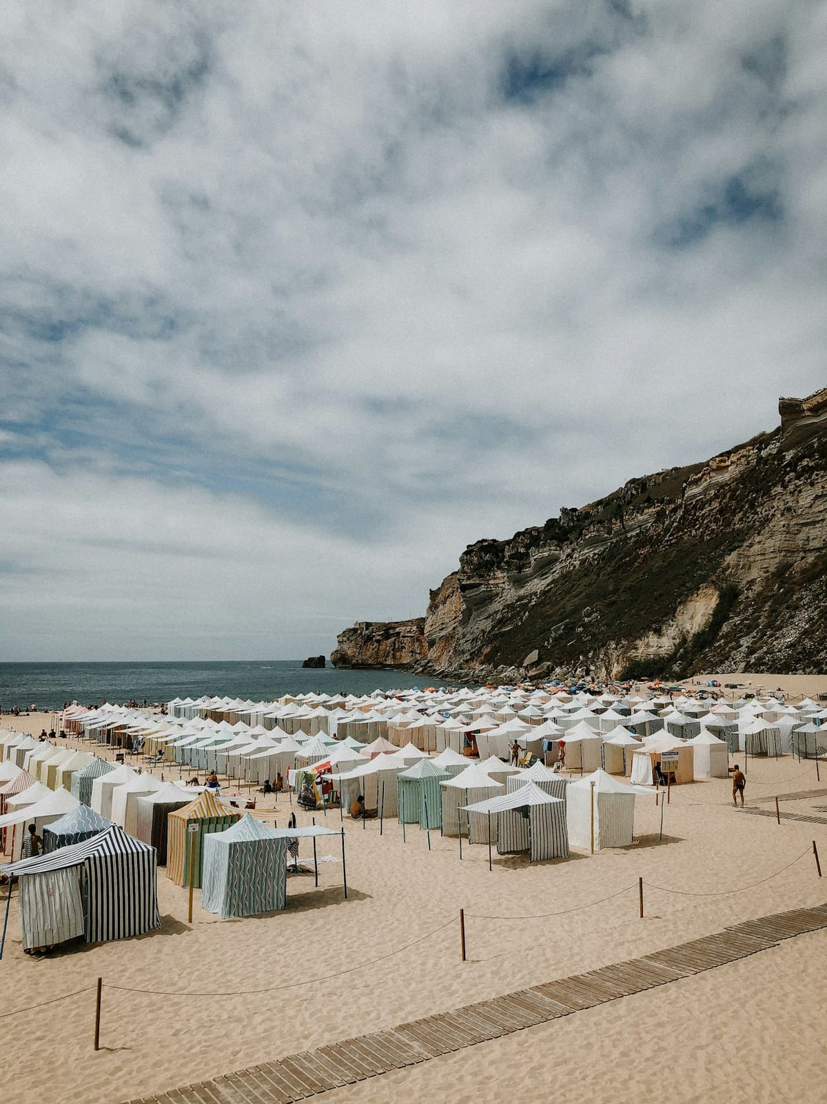
- Costa de Prata (Setúbal–Aveiro): the central Atlantic flank. Comporta, Carvalhal, Tróia (the Sado-mouth peninsula that the new ferry network and the SOL-permanent-structure investments now centre), Praia de Mira, Praia de Quiaios, Figueira da Foz, Costa Nova, Barra (Aveiro). Cooler water (~15-17°C), strong rip currents, supervised season concentrated June-September.
- Costa Verde (Porto–Caminha): the colder northern Atlantic. Praia de Matosinhos (metro-accessible from central Porto), Praia da Foz do Douro, Praia de Espinho, Praia da Aguda, Esposende, Vila Praia de Âncora, Moledo. Water in the 14-16°C range; supervised season tighter; the surf scene is strong.
- Açores: the volcanic-archipelago bathing complexes — Lagoa do Fogo (São Miguel, with Praia das Furnas variants), Praia de Santa Bárbara (Ribeira Grande), Caloura, Mosteiros, plus the saltwater rock-pools (piscinas naturais) at most island littorals. Year-round bathing temperatures roughly 17-22°C; the supervised season extends.
- Madeira: the volcanic-island coast, with rock-pool complexes (Porto Moniz, Seixal) and the Funchal urban beaches plus the Porto Santo islet (the only large continuous sandy beach in the archipelago). Year-round mild bathing temperatures; the supervised season extends beyond the continental window.
The SoSafe Alerts system — and what to do in a rip current
The SoSafe Alerts SMS system, run by the Autoridade Nacional de Emergência e Proteção Civil in coordination with the Marinha Portuguesa and IPMA, pushes beach-and-coast hazard advisories to mobile phones in affected geographic cells when conditions warrant — heavy-storm warnings, dangerous-swell forecasts, search-and-rescue activations. Foreign residents on a Portuguese SIM are inside the system by default; tourists on roaming may or may not be reached depending on the carrier handshake.
For the rip current — the single most consequential beach-safety hazard on the Portuguese Atlantic coast — the operational rule is to not fight the current: swim parallel to the beach until you are out of the rip's pull, then swim back to shore at an angle. ISN lifeguards drill this and signal it actively; the bandeira amarela is often a rip-current-active flag.
Practical access — getting to the beach
- Lisbon Coast: Linha do Estoril CP rail corridor (Cais do Sodré–Cascais) is the spine, with stops at Carcavelos, Estoril, Cascais; the Carris Metropolitana network handles the Caparica side from the Cacilhas / Trafaria ferry transfers.
- Cascais–Sintra: Linha do Estoril to Cascais, then SCOTTURB or the local 405 to Guincho/Praia Grande/Praia das Maçãs.
- Costa da Caparica: Cais do Sodré ferry to Cacilhas/Trafaria, then bus; or metro Almada line to Pragal, then bus. Summer Pragal-to-Caparica shuttle in operation.
- Porto Coast: Metro do Porto Linha A to Matosinhos for Praia de Matosinhos / Praia Internacional; STCP buses cover the rest of the coast inside the metropolitan boundary.
- Algarve: Próximo / EVA bus network connects Faro–Lagos–Sagres; Linha do Algarve CP between Faro and Lagos; rented cars for the cliff-cove corner of the Sotavento and Barlavento.
- Costa de Prata + Costa Verde: mostly car-access; CP urbanos for Aveiro/Espinho-cluster; local bus services for the Setúbal/Comporta/Caparica chain.
What to bring (and not to do)
- Bring sun protection. The UV index in Portuguese summer routinely reaches 9-10 on the Algarve and 8-9 on the Lisbon coast. SPF 30+, reapplied every two hours, is the SNS24 / Direção-Geral da Saúde public-health line.
- Bring water. Beach concessions sell it; carrying it is cheaper.
- Respect the cordon. The supervised swimming zone is the rectangle marked by ISN signage between the lifeguard tower and the cordoned-off zone. Outside the cordon is uncontrolled territory.
- Do not swim under a red flag. The Polícia Marítima and the GNR can and do issue coimas; the more consequential risk is the rescue you don't get because the lifeguard cannot enter a closed-flag zone without authorisation.
- Do not light fires or barbecues outside designated zones. The wildfire-season legal regime extends to dune ecosystems; ICNF and Proteção Civil enforce.
- Do not collect shells, sand or rocks in protected areas. Most of the Costa Vicentina, the Açores littoral and parts of the Algarve coast are inside Parque Natural or Rede Natura 2000 boundaries.
Why the beach matters for the foreign-resident reader
The beach is the single most universally-shared free amenity in Portugal. The 1,793-kilometre continental coastline and the volcanic-island arcs are public goods that the foreign-resident community, by integrating into the Portuguese summer ritual, accesses on the same terms as the resident population — the parking is the same, the lifeguard service is the same, the water-quality monitoring is the same, the beach-bar concession is the same. The Bandeira Azul, ISN, Águas Balneares and Praia Acessível architecture is the institutional layer that turns that public-good into a navigable, predictable system. Knowing how that architecture works is the operational primer on what is, for many foreign residents, the highest-value piece of Portuguese daily-life infrastructure they will ever use.
Sources: Bandeira Azul 2026 list (Tier 1 institutional, ABAAE / FEE Blue Flag programme); ISN — Instituto de Socorros a Náufragos institutional regulations on beach supervision and the bandeira colour code (Tier 1 PT institutional, Marinha Portuguesa); Agência Portuguesa do Ambiente Águas Balneares classification system (Tier 1 PT institutional); Praia Acessível — Praia para Todos programme (Tier 1 institutional, Turismo de Portugal + INR); Direção-Geral da Saúde sun-safety and bathing-water guidance (Tier 1 PT institutional); Autoridade Nacional de Emergência e Proteção Civil SoSafe Alerts substrate (Tier 1 PT institutional); IPMA bathing-season weather and swell data (Tier 1 PT institutional); EU Bathing Water Directive 2006/7/EC substrate (Tier 1 EU institutional).